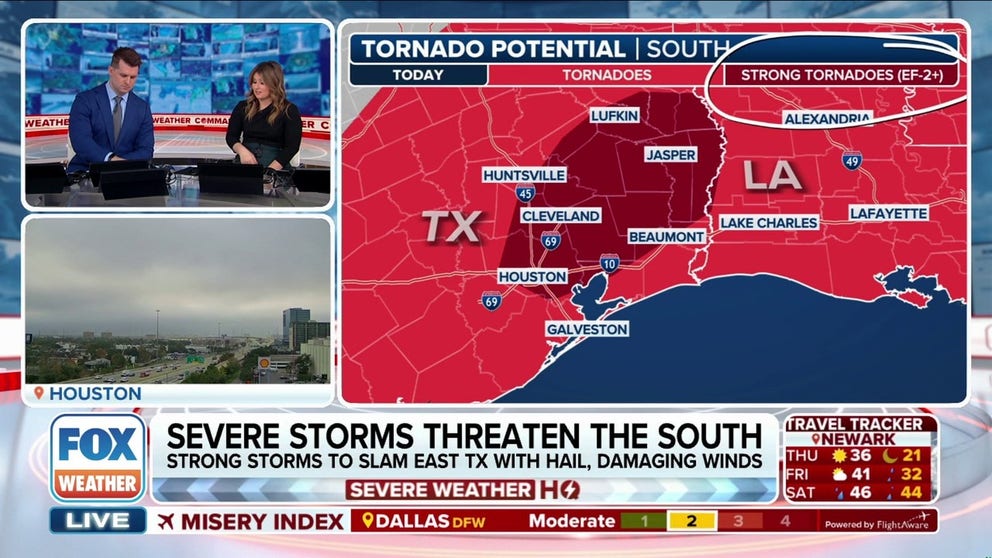
HOUSTON – The nation’s fourth-largest city is facing a serious severe weather[2] threat Thursday as storms tear across the South.
NOAA’s Storm Prediction Center has outlined an area in Southeast Texas[3] in a Level 3 out of 5 severe weather
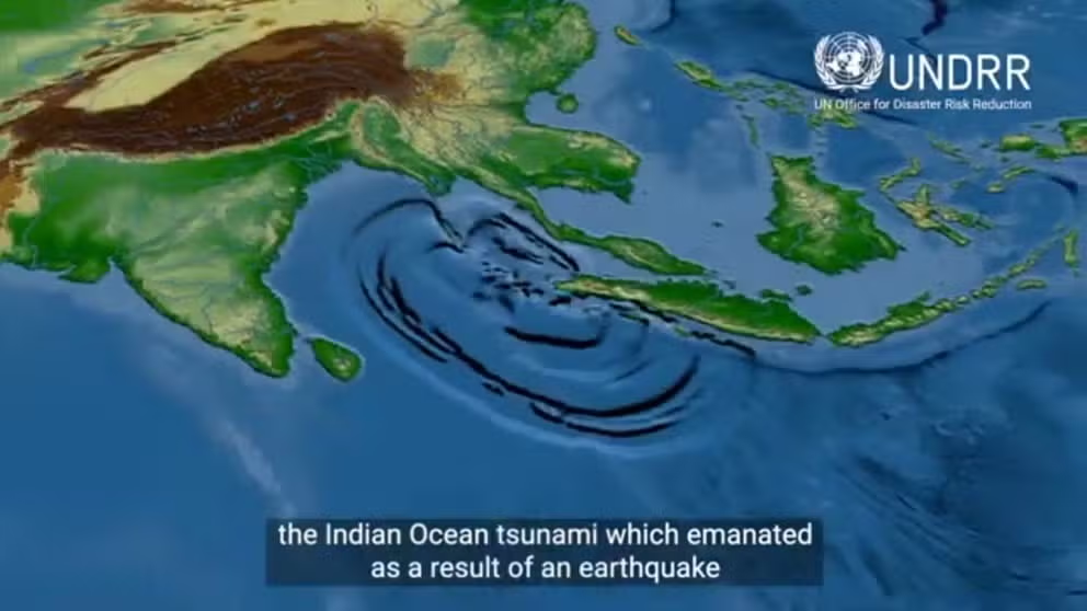
Twenty years have now passed since a massive earthquake and subsequent tsunami[1] devastated communities in Southeast Asia, resulting in more than 220,000 confirmed deaths and millions displaced following the historic event.
On the morning of Dec.26, 2004, an
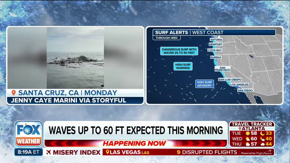
MARINA, Calif. – Rescuers continue to search for a man who was swept out to sea when rough surf hammered the Northern California[2] coast earlier this week even as more powerful waves[3] are set to hit the same area again.
The turbulent Pacific
FOX Weather crews covered all kinds of extreme weather[2] events during 2024, from hurricanes[3] to blizzards, from tornado[4] outbreaks to historic flooding.Coverage of the recovery from those disasters continues.
While in the field reporting across
AROSA, Switzerland – Snowboarder Sophie Hediger, who represented Switzerland at the 2022 Winter Olympics in China, died in an avalanche[2] Monday, according to the country’s ski federation.She was 26.
In a statement issued Tuesday[3], Walter Reusser,
AROSA, Switzerland – Snowboarder Sophie Hediger, who represented Switzerland at the 2022 Winter Olympics in China, died in an avalanche Monday, according to the country’s ski federation.She was 26.
In a statement issued Tuesday, Walter Reusser, CEO Sport at
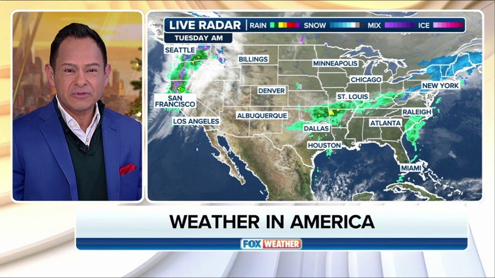
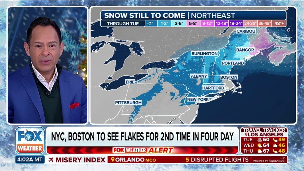
NEW YORK – As millions begin the trek home from the Christmas holiday[2], they'll be dealing with wet conditions to close out the week with rain and thunderstorms[3] expected across a good swath of the country.
Meanwhile, snow levels are dropping
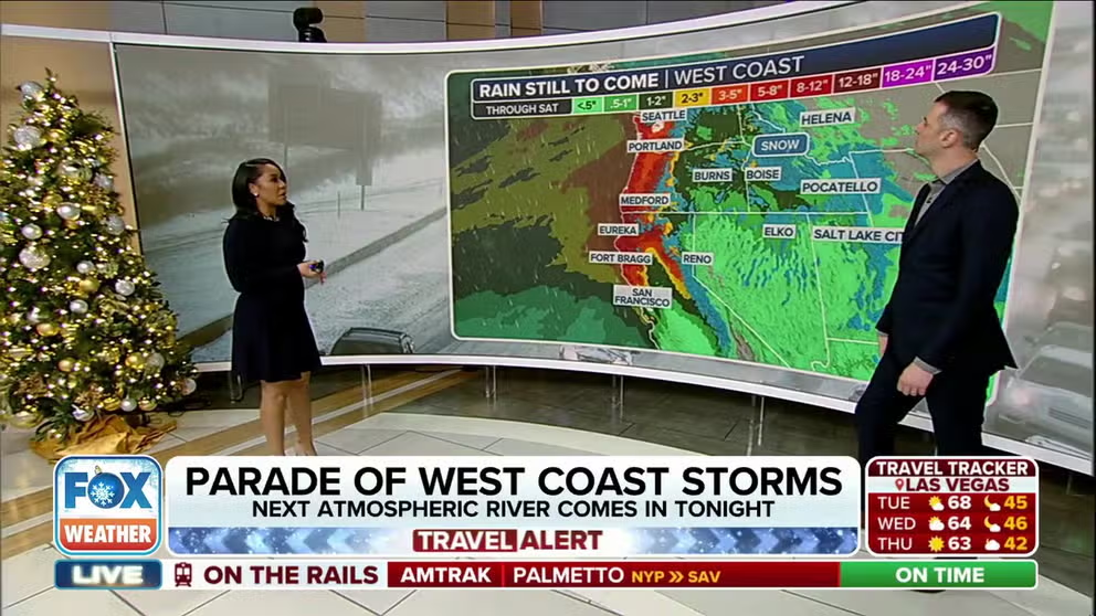
Surfers and swimmers are being told to stay out of the Pacific Ocean[2] this week as up to 50-foot waves will pound the shores of California[3], causing life-threatening conditions that have prompted multiple water rescues.
Multiple atmospheric rivers[4]
 03:38[1]
 03:05[1]
 02:55[1]
 06:51[1]
 01:09[1]
 00:58[1]
 07:07[1]
 02:32[1]